
I've noticed a couple of instances where maps out here in the Western Slope have changed over time. I'm not talking about expanding urban areas, but features that once were there and then vanished. This was the case of the "waterfall" in Lipan Wash (as described here). Another curious feature on older maps was a waterfall, or in fact two such waterfalls in Spring Creek Canyon. I doubted the existence given the fact that the waterfall was not described on newer maps, the drainage was relatively short and the creek itself is always noted as "intermittent". Still, I was curious and there was a trail nearby, so I figured I would check it out. For all I knew, the waterfall(s) could have been spring-fed.
I ventured out early in the afternoon on this beautiful day in May, equipped with plenty of water and daylight. I access the trailhead, I took I-70 east from Grand Junction into the De Beque Canyon to the Cameo exit (46). I continued west past the old coal-fired power plant on Coal Creek Canyon Road to the Coal Canyon Trailhead. When I arrived, there were several vehicles and horse trailers there.
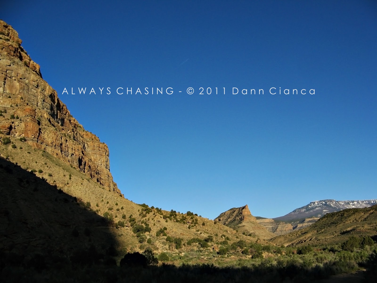
The trail climbs immediately north to a divide between Coal Canyon and Main Canyon, then drops down into the latter. From the divide, I was afforded with beautiful view to the east of an unnamed prominence between the canyons, the palisades of the De Beque Canyon and of course, Grand Mesa. (seen below)

Not a bad view!
When I reached the bottom of Main Canyon, I was pleasantly surprised to find the creek, Jerry Creek, flowing. When one is hunting waterfalls, the water part can be important. The trail then heads northwest up Main Canyon for about a mile. I ran into a hiker or two on the trails, but it wasn't too busy. I also saw four mustangs on the other side of the creek. They were deep in the Piñon-Juniper scrub, so I couldn't see them well, but one gave me a good opportunity for a picture.

Who's Gonna Ride Your Wild Horses?
After a mile, I reached the junction of Main Canyon and Spring Creek Canyon, which branches to the southwest. Here, I was a little disappointed to find Spring Creek bone-dry. Still, I carried on, hoping. After about a half-mile, the canyon elbows to the west-northwest. Here, I could see a bit of water seeping out of the cliffs to the south, but it wasn't reaching the wash. Also, this bend was guarded by a very impressive hoodoo, which I'll talk about more below.
I continued upstream (if you will), though I will admit progress was a bit slow. Most of the trail was in the wash was actually deep gravel. It was like walking through a half-foot of snow. It wasn't impossible but certainly not easy.
At the next junction, the actual Spring Creek Trail follows the canyon joining from the southwest, but my target was the canyon to the north-northwest. At this junction, I stopped and rested for a while, admiring the amazing hoodoos.

Imposing Hoodoos
I continued along the trail which dipped in and out of the wash along the still-dry Spring Creek. At one point, the trail climbs along the north side of the canyon to avoid an impassable boulder pile / drop. I was startled by a relatively large creature on the ground and was happy to find I was looking at my very first collared lizard. I tried to get a shot of it which turned out okay. I've never been much of a wildlife photographer.

Collared Lizard
The trail continued between gravelly wash, dusty side trails and occasional obstacles. As the canyon tightened, however, the obstacles seemed to be more prevalent. I passed another drainage coming in from the southwest a half mile past the previous and a third junction a half mile later. At this junction, the official Spring Creek is the branch to the southwest. However, the falls are noted on the canyon that branches to the northwest, so I continued up that canyon.
The trail became more and more demanding as boulders and drops frequently blocked my path. It was fairly tiring have to climb or navigate around them. Still, I carried on, determined.
Eventually, the canyon really seemed to tigthen and the mid afternoon light was casting a golden glow down into its recesses. I kept thinking about how beautiful this would be were there an active stream moving through its bottom. Instead, there were occasional brackish puddles lined with salt. And they were few and far between.

Though the terrain was perhaps the most aesthetic, the canyon became very difficult to navigate with several drops that were just too high or too treacherous to climb. At times, I almost turned around, but figured I'd try and navigate around to the best of my ability. The tightness of the canyon made this difficult, but I was eventually able to make a pass along the southern slope of the canyon. It was not easy and took a considerable amount of time. However, when I was able to return to the wash, I finally found myself at one of the "waterfalls". I was disappointed that it was dry, but happy to have made it.

The "Falls"
It is possible that there is another "waterfall" less than a quarter mile farther up-canyon, but I was not able to navigate anymore upstream. So, I sat and had a little water and then explored the area for a while. There was moisture at the base of the falls and a bit dripping out of the walls, but nothing was really flowing. The area was relatively lush due to the moisture but there was also a high amount of minerals or salts that were present as well. Some of the deposits looked like feta cheese.


A salty cliff-side seep.

Mineral deposits.

Feta!


Vicinity shot of the falls area.
I rested for twenty minutes or so before heading back down-canyon. I explored the option of following the wash but realized it would be just as difficult to descent as ascent, so I found my "short" cut and worked my way downstream that way.

Small puddles in the creek bed.
This canyon was a little different than other places I had explored. I will give it a few uniqueness points. Of course, the fact that I kept flicking ticks off of me was a bit annoying, but I also saw cool geological formations like those below:

Strange formations. Perhaps river rocks trapped in mud stone?

Hand for scale. (That's no lady-hand)


And then, of course, there were the hoodoos. The highest concentration of hoodoos was at the canyon junction I spoke of earlier in this entry. I called it the "Hoodoo Chorus" since they seem to be huddled together.


"Hoodoo Chorus"


But further down-canyon was my favorite hoodoo of all. I spoke of this one earlier as well: the lone hoodoo at the elbow. It stands tall, like a sentinel guarding over the canyon bottom. I also could not help but notice that the rock on top had an uncanny resemblance to the skull of a Tyrannosaurus Rex. For that reason, I refer to it as the T-Rex Hoodoo. Let me know what you think. If you have a good sense of humor, you may also want to refer to it as the "T-Rex Pez Dispenser Hoodoo".


"T-Rex" skull

"T-Rex Hoodoo"
The sun was beginning to get low in the sky, so I made haste for the trail head.

Looking out of Spring Creek Canyon to Main Canyon.
Back into Main Canyon now, it was almost Golden Hour!
Looking east down Main Canyon.


Jerry Creek

Jerry Creek and Main Canyon.
As I left the canyon bottom and worked my way back up to the divide into Coal Canyon, I saw the horses again. I think they were the same four, but I'm not completely sure.

Atop the divide, the surrounding area absolutely glowed with the evening light. It was fantastic!


Unnamed Prominence (left), Grand Mesa (right)

I refer to this as "Cameo Point"
Finally back at the trail head, I noticed that quite a few vehicles... BLM and Sheriff's Office were just leaving. I spoke with a couple of women who were loading their horses back into a trailer and apparently, they were riding and one lost a cell phone signal with her husband who mistakenly thought she was lost. He called for a search party which included a helicopter (that I recalled flying over the area at some point). But, no harm done.
In talking with members of the search & rescue squad at a later date (for a story at work), they told me you shouldn't hesitate to call for help if someone you know is lost or if you get injured and need help. Most of the squad is comprised of volunteers and they are happy to go out and help. Of course, they would remind you be prepared for going outdoors and always letting someone know where you are going. In my case, I feel like I achieved both.
The hike was just a little over 8 miles round-trip and I was a bit tired, especially with all of the climbing, jumping, crawling, butt-scooting, gravel-plowing and tick-flicking, so when I got back into town, I treated myself to a chocolate malt at the Sonic in Clifton. I deserved it.
Here's a map of the adventure if you'd like to follow along (you can click for a larger version):

Though there were no active waterfalls, the terrain was beautiful (if not a bit harsh) and I was happy to see the collared lizard and the wild horses. The sunset was just a bonus.
Dann.


No comments:
Post a Comment