Monday, April 09, 2012

2011 Storm Chase 15 - July 8th - Desert Disappointment

Catching up on a few 2011 entries since I'm still backlogged on 2012 imagery...

This entry details a storm chase from July 8th, 2011.

I was at reporting at work on this particular Friday afternoon.  We had been in a Monsoon pattern for a while and that was keeping thunderstorm opportunities more frequent.  
 I was downtown shooting a story (or attempting to) with my co-worker PJ.  My phone was blowing up with text from Eddie and Drew about storms in the area, which I could see to the west.  I was trying to ignore them to the best of my ability as I couldn't exactly do anything about it.  Winds were whipping through the downtown area as outflow from the storms passed.  The strongest cell was north of town, heading into the desert. 


I talked with my boss and he told me I could make a pursuit, so I headed off to the north side of town, cursing traffic in the mean time.  Drew, who was also out chasing, met up with us and jumped in the car.  The storm was on its way out of the valley at this point, but I wanted to see what it had put down since it was carrying a decent amount of reflectivity.

We drove north into the desert, which was fine until we left the gravel road and got into the clay.  PJ and Drew seemed horrified at how the vehicle reacted to the road, but I was used to it and was drifting adeptly in all-wheel drive.  I don't think they've experienced the "cake batter" before.  Long story short, we didn't find any hail, though we did find a golf ball.  It fooled us at first.  Then, it was back to the station empty handed.  

Detail Map:


STATS
Mileage: 24
2011YTD Mileage: 1686
States: Colorado
SPC Risk: Probabilistic (Wind)
Max Hail: None
Tornadoes: None
Other Phenomena:  None
Applicable Mesoscale Discussions: None
Applicable Weather Watches: None
Storm Reports for July 8th

Dann.

Sunday, April 01, 2012

2012 - March 18th - Hanging Lake Trail, Spouting Rock & Dead Horse Creek; White River National Forest

On day two of my cousins being in town, we headed for a Colorado favorite: Hanging Lake.  (Day one's adventure can be found here.) It's best to avoid the area during the summer months as the parking lot is often full.  Though it was a weekend day, the weather was not going to be nice.  I was hoping that it would detract the crowds.  I was lucky to visit on a very "dead" day last spring.  Of course, it was a week day and the weather was a little cool back then as well. 

Brian had to head back to the Front Range to study; he's in the last semester of his graduate program.  So, I thought it would be a good idea to go some place that would be on his way home and just have him follow us out there.

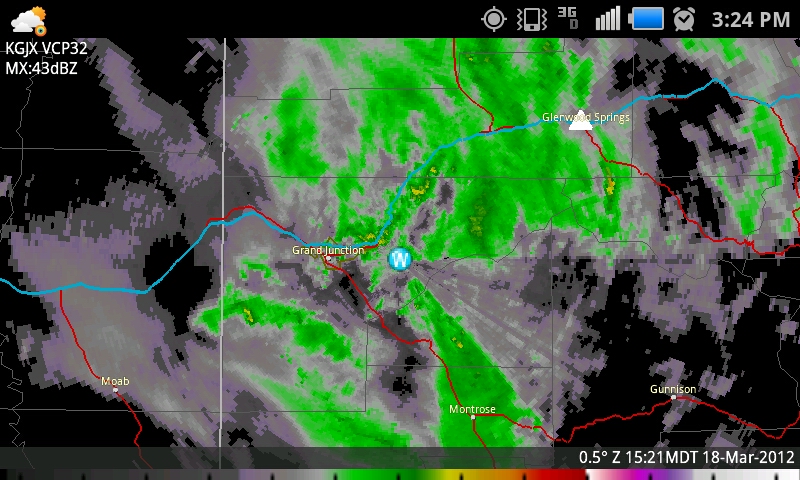
I think we all slept in a bit after the previous night's fun, which was probably good.  We hit the road by late morning under cloudy skies and I knew that we'd be facing rain in the afternoon when the cold front arrived and possibly more light warm air advection stratoform precip before then.

It's funny traveling with Brad and Brian.  Both are avid fishermen and they look at the rivers like I look at the skies.  I think there is a mutual respect of each other's passion.  

The parking lot was half-full as we arrived around noon.  Brian didn't have a lot of time to waste, so we immediately began our trek up the hill.  I decided to keep my camera stowed on the way up the hill to save time and only shoot on the way down, so Brian could go ahead if he was running short on time.

We found the trail to be muddy and quite icy in spots.  I witnessed several people fall on their hikes down.  Though the previous night's revelry did have some impact on my constitution, I trudged on up the hill and remained steady on  my feet.

There was more snow than on my previous trip, so that subtly altered the character of the trail, which was nice.  Another strange thing was that the water level in Dead Horse Creek was lower, but it was flowing in more areas.  Last time, the creek disappeared beneath the earth for several long stretches.  Perhaps, though the water level was lower, the ground was frozen which resulted in more surface water in spots.  That is just speculation.

It rained and snowed occasionally, but never heavily on the way up.  After reaching Hanging Lake, I waited for people to cease climbing out onto the long log which floats upon the surface and then paused for a few pictures.  Brad and Brian stared into the water and watched the trout (or char, perhaps) swim about.

I'm not sure what it is with Hanging Lake (and I found this last time as well), but I was having trouble being happy with my compositions.  On the bright side, or dark side I suppose, it was dark enough for longer exposures, so that is a plus.  Here are several pictures that I'm not necessarily sure if I like.  Enjoy. 


After hanging out at Hanging Lake for a bit (get it?), I wanted to show them Spouting Rock.  So, we hiked a little farther on the trail... it only takes a couple of minutes.  I was happy to see a giant ice pillar next to the falls, which still emerge directly from the face of the rock.  At some times of the year, an additional waterfall pours off the top of the cliff.  The ice pillar is a result of that flow.  We spent some time looking around and I took probably too much time trying to get some good images.  I have trouble deciding which ones are more presentable, so I've posted quite a few.  


I could tell Brian was ready to get on the road, so I tried to put my camera away, but not before getting a few more shots.  I was crouched behind a rock, against the wall to get the best angle when a woman walked up.  Apparently she didn't see me until she was right on top of me, because she jumped about a foot in the air.  I captured a couple of good frames from that spot, though.


The drizzle continued as we began our trek down the canyon.  I stopped once more at the top of the falls over Hanging Lake for a couple of shots.

Rain & Snow obscuring the view.


On our way down, I ran into a young lady that didn't have a camera.  I awkwardly tried to explain how to get to my blog.  (Hope you got a chance to check out the photos!)  It made me realize that I need to have an easier name than "bigskyconvection" ... thus my eventual pull toward "alwayschasing."  Too bad I'm paying for hosting on the former and everything is already locked down there, including all of my old blog entries.  Eh, I'll figure it out some time... anyway, back to the trip.

Poor Brian did biff it once on the way down and luckily, I believe, didn't do any further damage to his arm.  I saw plenty of others fall too on the icy path, but I remained on my feet.  It was very difficult not to stop at every little riffle in the creek and take pictures, though I did stop at a few.


Once at the bottom, Brian headed back to Denver and me and Brad wandered on in to Glenwood Springs for a late lunch.  We were referred to Vicco's Charcoalburger.  I was hoping for a place to sit down and eat but I didn't realize it was a drive-in until we arrived.  At that point, I was too hungry to go some place else.  We originally planned on eating outside, but the cold front arrived at that moment...  FROPA! ...and ruined any thought of that.  It was incredibly windy!  So, we ate in my car.  Honestly, I wasn't a big fan.  Both Brad & I had mushroom & Swiss burgers.  They use fake American-style Swiss cheese, though, which is awful.  The smoke sauce was decent, but the burger overall was kind of disappointing.  The chocolate malt was runny and unpleasant as well.  We had full bellies, though, so I suppose that's all that really mattered.

On the way back, we battled light rain and wind with occasional bursts of heavy snow.


We topped off the evening by watching John Carter of Mars, which was pretty good.  A lot of it was shot in Utah and I recognized several areas which I told Brad we'd be driving by on the next day.  Our plan was to visit Arches.

Here's a useful map:


Dann.

2012 - March 17th - Bridgeport/Deer Creek Petroglyphs & Big Dominguez Canyon, Dominguez-Escalante National Conservation Area/Dominguez Canyons Wildnerness

My cousins Brad and Brian were coming into down for Saint Patrick's Day weekend.  I basically grew up with Brad in Montana and I lived with Brian and his family in Denver for a year when I moved to Colorado.  Brad and Brian are also cousins to each other.  I hope that all makes sense.  Anyway, both were coming into town and I wanted to show them some of the sights.  Our first hike excursion was to the Dominguez Canyon area.  I had been there once previously (read here) and wanted to visit again, especially to show others around. 

Both arrived on Friday night (the 16th), one by car and one by air.  After a hearty breakfast of Swedish Pancakes (a family favorite), we hit the road on St. Paddy's Day morning.  This time around, I wanted to see if I could find some petroglyphs near the trailhead.  On my previous journey, I came across the well-known 'glyphs in the canyon, but another local adventurer (rock art fanatic) told me of another panel near the trailhead.


It was a warm day already and the wind was starting to pick up in advance of the next storm that would arrive on Sunday.  A few high clouds, many terrain-induced were already setting up.

At the trailhead, I looked around for possible locations of the panel and discovered it without too much trouble.  Again, with respect to cultural preservation, I won't divulge the exact location.  But industrious folks who might decide to look for it should be able to find it without much trouble.  Just a reminder, though... don't touch!  Stand back, in awe and snap photos.  


We explored the vicinity a bit and looked an old structure.  I'm not sure if it was created by the picture-makers or someone else, but it was still cool to see.


As we were exploring around, I could swear that I smelled smoke.  It turned out that someone had camped there the night before and did not fully extinguish their fire.

Pleased with the discovery of the "new to me" panel, I was eager to show my cousins the rest of the canyon, so we hit the trail.  There were several other groups of people and a few cars at the trailhead, but it wasn't extremely busy.

Despite the wind blowing sand into our eyes occasionally, it was a beautiful day.

The Gunnison River and Sand Flat beyond.


Looking downstream on the Gunny from the pedestrian bridge to the old Bridgeport bridge.

I'll spare you the details of the entire hike and skip to the highlights.  Last year, during the flooding in May and June, part of the trail had washed out.  It was repaired to some extent and open to hikers but nothing else.


A dead Cottonwood at the canyon entrance.

Our first stop was the big waterfall.  The water was a lot muddier than last year!  We hiked around the waterfall and sat on an opposite ridge to eat some beef jerky, trail mix and Starburst jelly beans.  Here are several photos of the falls.  I couldn't decide which one I liked the best, so I've posted them all.  I hung around on the ridge while Brad and Brian hiked back over to the top of the falls.


And now a couple with Brad and Brian for scale.  The waterfall is rather impressive and surprisingly not listed on USGS maps.  It does run year-round as I understand. 


I joined them at the top of the falls and then took them a bit upstream to see the good petroglyph panels.  We stopped at all the places that I visited last time, though avoided one panel since there was a group of people smoking pot there.  I'm sure they had their MMJ cards.

Anyway, as we began to wander back, we noticed a couple of people at the top of the rubble at the base of the canyon wall.  Sure enough, there was another panel; one that I had not seen on my previous visit.  I was suddenly quite excited.  As soon as they started to work their way down, we headed up. 


I was pretty excited to have found two new panels on a hike I had already been on.  Plus, it was great to be able to show the area to my cousins.  On our way out of the canyon, their eyes were glued to the canyon walls looking for more.  After being in the area for a while, I'm almost used to them... but it's awesome to see someone discovering them for the first time. 

I was a little worried about Brian.  He was in a pretty bad car accident a couple of months ago and ended up with fractures and a dislocated elbow.  His arm is still healing and he had to wear a sling while hiking.  Also, he was sick the night before.  He was a trooper though and seemed fine on the hike.

When we got back to my place, I realized that though I had taken my sunscreen out, I neglected to put any on and was dealing with a wicked sunburn.  I wasn't going to let that bother me, though.  I invited a bunch of friends over and we grilled up some beer sausage made from elk and a ton of Hebrew National Hot Dogs.  Then, it was a night of revelry downtown... it was Saint Patrick's Day after all.

The last thing I remember that night was the absolutely epic wind coming out of the south as we walked home.  I soaked it up, to say the least.

Here's a useful map (click for larger):

Dann.
PS:  We weren't done yet.  Hanging Lake was next on our agenda.