
Had another great night at our monthly weather-people meeting. We had some new faces this time to go along with the old and weathered faces such as my own. :)
I met some old friends early that couldn't stay late at 7PM and before I knew it, it was a quarter past one! It's easy to get lost in the stories and in the company of good people.
Next event: January 3rd
Sunday, November 30, 2008
Saturday, November 29, 2008
Denver Area Snow (November 28)
So, we're getting some snow ... I almost went to bed but at the last minute, decided to go out and see if I could get a good vantage to take some pictures or video. The pictures came out pretty well, but the video is boring (cars driving on wet highway ... zzzz) Here are a couple select photos.


Unfortunately, when I got home, I slipped on the grass and landed on a raised manhole cover. Most of my weight went onto my left elbow/arm and left thigh. In the process, I smashed my phone (the screen is screwed up now) and really hurt my arm. It's not broken ... but my hand is half-numb and my elbow is in a good deal of pain.
.... still trying to decide if it was worth it or not.
Dann.
PS: The photos were time exposures, ISO 80, F8.0. I used the flash on purpose to get snowflakes 'in the act'
Friday, November 28, 2008
Incredible Brisbane, Australia Storm Video
Severe storms ravaged the Brisbane, Australia area on November 16th. This is by far the best video I've seen of the event:
Tuesday, November 25, 2008
The Fire Of Sunset
Wow, talk about dry! KBJC had a nice katabatic wind event this morning, mixing the already dry-as-a-bone atmosphere down to 1% humidity. The temperature was 57ºF with a dewpoint of -38ºF ... that's a dewpoint depression of 95º. I don't think I've ever seen that far of a spread before. That's one of those days where you take off your sweater and start a forest fire!
KBJC (Rocky Mountain Metropolitan Airport) is dead-center in the image below (click for larger)

High clouds moved over the area over night, leaving bleak, overcast conditions throughout the day. In addition to the high cirrus, a huge wave cloud set up. I kept reminding myself all day to make sure and catch the sunset.
By the time sunset was approaching, the wave started to disintegrate, which saddened me. However, some nice lenticulars had shaped up to the north. I had camera and tripod handy, so I got up on the roof and started taking shots. I went completely into manual mode on my point-and-shoot. This was the first time I've done that for anything except lightning. It was kind of exciting and I experimented a lot before running out of batteries. (I thought I had an extra pair, but did not.) I took quite a few photos, however, and I'll share a couple.

Sorry about the horrendously off-center placement of the watermarks.

Tweaked contrast, saturation, brightness, and added 'watermark'.
Dann.
Monday, November 24, 2008
Dry!
The current dewpoint depression at Rocky Mountain Metropolitan Airport is 86ºF!!!
Current temp: 59ºF, 2% humidity = -25ºF Td
Here is the raw METAR:
KBJC 242147Z 30006KT 60SM FEW250 15/M32 A3020 =
We're also seeing temps in the 60's around the metro area with humidities between 3-6%. KBJC (Rocky Mountain) is situated on a hill in Broomfield, Colroado. Winds are out of the northwest right now (downslope), causing a little extra drying.
Close to work at KAPA (Centennial Airport), we're sitting at 64ºF with 4% humidity. That gives us a dewpoint of -13ºF (Td depression= 77ºF)
Unreal!
(sorry for the weathernerd excitement)
Dann.
Thursday, November 20, 2008
Colorado County Tornado Frequency

According to the map above (provided by NWS Denver), the top 10 Colorado counties as far as tornado frequency are as follows:
1. Weld County
2. Adams County
3. Washington County
4. Lincoln County
5. El Paso County
6. Kit Carson County
7. Arapahoe County
8. Elbert County
9. Logan County
10.Yuma County
However, when divided by the area of each county, the list changes dramatically:
(previous ranks in parenthesis)
1. Adams County (2)
2. Arapahoe County (7)
3. Denver County (25)
4. Douglas County (14)
5. Weld County (1)
6. Sedgwick County (19)
7. Phillips County (17)
8. Morgan County (12)
9. Washington County (3)
10.Elbert County (8)
This, of course is assuming that all tornadoes that form are reported.
I would like to go back and reanalyze using an average population density over the time period listed and further rank the counties by how likely any existing tornado is to be reported by the public. Of course, Denver area will be forever skewed by the "non-supercell tornado alley"!
Dann.
Wednesday, November 19, 2008
Just Wait A Second
You know, I really hate the expression "If you don't like the weather in _____, what a second." It seems that every time I meet someone from some state, they say that like it's the secret thing to say about their home state. If you don't like the weather in Colorado ... bah bah ... but with that said ... * ahem * ... what a change is in store for us here in Colorado!
First, let me talk a little about the warm weather here in the West. We've had a persistent ridge for the past week or so, bring unseasonably warm temperatures (and giving those nice Santa Ana winds in California that the fires love). There was some wonder as to whether Denver would set its all-time record November high yesterday (the 18th). We did set a record ... but were a couple shy of the all time:
RECORD EVENT REPORT
NATIONAL WEATHER SERVICE DENVER CO
415 AM MST WED NOV 19 2008
...TWO RECORD TEMPERATURES SET IN DENVER FOR NOVEMBER 18TH...
AT 242 PM MST THE TEMPERATURE AT DENVER INTERNATIONAL AIRPORT REACHED 78 DEGREES. THIS ESTABLISHES A NEW RECORD HIGH TEMPERATURE FOR THIS DATE EXCEEDING THE OLD RECORD OF 74 DEGREES SET IN 1995.
THE LOW TEMPERATURE ON TUESDAY WAS 47 DEGREES. THIS IS A RECORD HIGH MINIMUM TEMPERATURE FOR THE 18TH. THE OLD RECORD WAS 43 SET IN 1949 AND PREVIOUS YEARS.
Also, in Butte, Montana, we saw record "heat" (yes, I'm pretty much focused on Denver and Butte as far as records are concerned.)
RECORD EVENT REPORT
NATIONAL WEATHER SERVICE MISSOULA, MT
1240 AM MST TUE NOV 19 2008
...RECORD HIGH TEMPERATURES SET AT BUTTE AND KALISPELL MT...
A RECORD HIGH TEMPERATURE OF 62 DEGREES WAS SET AT BUTTE MT YESTERDAY. THIS BREAKS THE OLD RECORD OF 61 SET IN 1949.
A cold front pushed through here in Denver today. Winds switched to the east and while it didn't cool down immediately, it sure has tonight. We're sitting at 37ºF at my apartment at about 10PM and that temperature should drop below freezing by early morning. Now, the surface high distant to our northeast could get amped up tonight and give us some shallow upslope. Moisture is finally starting to increase here and the prediction of freezing drizzle seems possible. Guess we'll see tomorrow morning when I'm driving to work.
* * *
I'd also like to say that I really enjoyed the Wild Western Weather Seminar last night. I'm not trying to be nice or suck up, but I thought Tony Laubach's "what if" scenario on the Windsor tornado moving through the Denver area was very well though out and interesting.
Also, I got to watch Lubacca 2008 Brilliant last night. The May 22nd footage is fantastic and had me on the edge of my seat! I would recommend purchasing it from Tony's website when it's available!!
Dann.
First, let me talk a little about the warm weather here in the West. We've had a persistent ridge for the past week or so, bring unseasonably warm temperatures (and giving those nice Santa Ana winds in California that the fires love). There was some wonder as to whether Denver would set its all-time record November high yesterday (the 18th). We did set a record ... but were a couple shy of the all time:
RECORD EVENT REPORT
NATIONAL WEATHER SERVICE DENVER CO
415 AM MST WED NOV 19 2008
...TWO RECORD TEMPERATURES SET IN DENVER FOR NOVEMBER 18TH...
AT 242 PM MST THE TEMPERATURE AT DENVER INTERNATIONAL AIRPORT REACHED 78 DEGREES. THIS ESTABLISHES A NEW RECORD HIGH TEMPERATURE FOR THIS DATE EXCEEDING THE OLD RECORD OF 74 DEGREES SET IN 1995.
THE LOW TEMPERATURE ON TUESDAY WAS 47 DEGREES. THIS IS A RECORD HIGH MINIMUM TEMPERATURE FOR THE 18TH. THE OLD RECORD WAS 43 SET IN 1949 AND PREVIOUS YEARS.
Also, in Butte, Montana, we saw record "heat" (yes, I'm pretty much focused on Denver and Butte as far as records are concerned.)
RECORD EVENT REPORT
NATIONAL WEATHER SERVICE MISSOULA, MT
1240 AM MST TUE NOV 19 2008
...RECORD HIGH TEMPERATURES SET AT BUTTE AND KALISPELL MT...
A RECORD HIGH TEMPERATURE OF 62 DEGREES WAS SET AT BUTTE MT YESTERDAY. THIS BREAKS THE OLD RECORD OF 61 SET IN 1949.
A cold front pushed through here in Denver today. Winds switched to the east and while it didn't cool down immediately, it sure has tonight. We're sitting at 37ºF at my apartment at about 10PM and that temperature should drop below freezing by early morning. Now, the surface high distant to our northeast could get amped up tonight and give us some shallow upslope. Moisture is finally starting to increase here and the prediction of freezing drizzle seems possible. Guess we'll see tomorrow morning when I'm driving to work.
I'd also like to say that I really enjoyed the Wild Western Weather Seminar last night. I'm not trying to be nice or suck up, but I thought Tony Laubach's "what if" scenario on the Windsor tornado moving through the Denver area was very well though out and interesting.
Also, I got to watch Lubacca 2008 Brilliant last night. The May 22nd footage is fantastic and had me on the edge of my seat! I would recommend purchasing it from Tony's website when it's available!!
Dann.
Tuesday, November 18, 2008
Wild Western Weather and the Milk River Supercell
Tonight I will be attending the 2008 Wild Western Weather Seminar. I was unable to attend last year, so this will be my first year. Tony Laubach and Tim Samaras will both be presenting.
Here is the agenda:
6:00 PM -- Mike Nelson Intro and welcome
6:20 PM -- Tim Samaras - Tornado Expert - featured in National Geographic Magazine, "Inside Tornadoes - The Latest Research: Twistex 2008"
7:00 PM -- Tony Laubach - Storm Chaser - "The Windsor Tornado vs Douglas County Landspouts"
7:40 PM -- Dr. Walt Lyons - Lightning Researcher - "Flash Facts - Red Sprites, Blue Jets and Other Rare Airities"
8:20 PM -- Ethan Greene - Director, Colorado Avalanche Information Center - "Avalanches and the Big Snow Winter of 2007-08"
9:00 PM -- Dr. Thomas Schlatter - NOAA's Earth System Research Lab and the University of Colorado - "The Pine Bark Beetle - A Canary for Climate Change?"
9:40 PM -- Questions
More information can be found HERE. If you're in the Denver area and want to go, there still may be seats available ... contact info is on the linked page.
* * *
The Milk River Supercell
This might be better placed in a separate post, but I wanted to mention it here anyway. My passion for meteorology was birthed and nurtured by Montana weather. It has long been my desire to intercept a tornado there. Before I moved to Colorado, I had never really gone storm chasing (according to my current definition of the term), though I did "follow" a few storms or go out onto a hilltop to take one in as it passed. I had the opportunity to actually chase in July of 2007. The setup was marginal, but I was able to intercept a beautiful, high-based storm off of the Crazy Mountains, providing one of the most beautiful stormscapes (in combination with the topography) that I have ever witnessed. There is an inherent beauty to the place, something, that I believe, sets it apart from elsewhere in the United States.
I feel very connected to the land and the sky in Montana and was very inspired after reading the story of Bear White Child of the Crow. (It's worth the read)
It is my intent to spend more time chasing in Montana in the next few years. While watching the weather elsewhere and especially locally, I still always have an eye on the weather in Big Sky Country, or known to some as "The Last Best Place." With the droves of storm tourists now piling onto the plains of Oklahoma and Kansas, tempered with the "try this at home mentality" after absorbing the myriad 'reality' storm chasing shows, it seems like Montana might be a good place to escape the crowd. Chasing has always been a spiritual experience for me, but a personal one at that. As much as I love to chase socially (and that has been the case with higher gas prices) ... I never feel more at home than when I am out under a storm, all by myself.
Montana doesn't have near as many severe days as most of the United States, but don't let that fool you. There are a couple favored setups where things can get absolutely wild. The state can be split in half climatologically with the mountains on the west and the plains on the east. There is one event that seems to happen every year, without fail, and sometimes more than once. I call this the "Milk River Supercell".
I intend to research this storm via climatology and in the field.
Here is a brief overview of the storm:
Most often, the Milk River Supercell forms off of the Rocky Mountain Front (not to be confused with Colorado's Front Range) and travels in an arc from west to east slightly north and then slightly south, roughly along the path of Montana and Alberta's Milk River. It often targets the city of Glasgow, MT before moving off into the Dakotas, sometimes as a mesoscale convective system. This storm usually begins as a low precipitation supercell and can sometimes evolve to have high precipitation characteristics. Though further research is required, it seems to form on days where abundant Pacific moisture is available in the mid-levels, usually associated with a short wave riding up along the mid to late summer Rocky Mountain ridge. At the surface, Gulf of Mexico moisture is plentiful thanks to the low level jet and a sometimes a Canadian moisture advection mechanism that I wish to study is also present. With the varying moisture sources and topography in Montana, it could seem like meteorological chaos ... but the boundaries can lend to some explosive weather. This is what I want to study and observe. It will take a more climatological approach at first and then hopefully get to study an event in the field. This could be difficult with my distance, uncertain (eventual) job placement, and having to rely on lucky timing, but it is something that I really want to be a part of.
One such storm on June 16th, 2007:
Glasgow NWS writeup
Severe Reports
Radar Loop
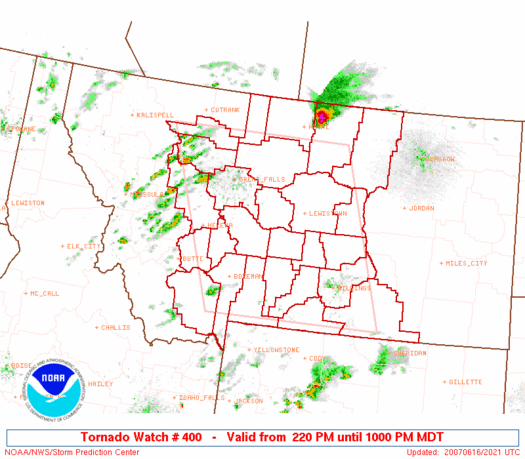
Sure, the Milk River Supercell isn't any more severe than the behemoths that form on the plains in the early spring, but it is special to me. With a poor road network, marginal phone service, and not very many people, it is literally just you and the storm.
Dann.
Here is the agenda:
6:00 PM -- Mike Nelson Intro and welcome
6:20 PM -- Tim Samaras - Tornado Expert - featured in National Geographic Magazine, "Inside Tornadoes - The Latest Research: Twistex 2008"
7:00 PM -- Tony Laubach - Storm Chaser - "The Windsor Tornado vs Douglas County Landspouts"
7:40 PM -- Dr. Walt Lyons - Lightning Researcher - "Flash Facts - Red Sprites, Blue Jets and Other Rare Airities"
8:20 PM -- Ethan Greene - Director, Colorado Avalanche Information Center - "Avalanches and the Big Snow Winter of 2007-08"
9:00 PM -- Dr. Thomas Schlatter - NOAA's Earth System Research Lab and the University of Colorado - "The Pine Bark Beetle - A Canary for Climate Change?"
9:40 PM -- Questions
More information can be found HERE. If you're in the Denver area and want to go, there still may be seats available ... contact info is on the linked page.
The Milk River Supercell
This might be better placed in a separate post, but I wanted to mention it here anyway. My passion for meteorology was birthed and nurtured by Montana weather. It has long been my desire to intercept a tornado there. Before I moved to Colorado, I had never really gone storm chasing (according to my current definition of the term), though I did "follow" a few storms or go out onto a hilltop to take one in as it passed. I had the opportunity to actually chase in July of 2007. The setup was marginal, but I was able to intercept a beautiful, high-based storm off of the Crazy Mountains, providing one of the most beautiful stormscapes (in combination with the topography) that I have ever witnessed. There is an inherent beauty to the place, something, that I believe, sets it apart from elsewhere in the United States.
I feel very connected to the land and the sky in Montana and was very inspired after reading the story of Bear White Child of the Crow. (It's worth the read)
It is my intent to spend more time chasing in Montana in the next few years. While watching the weather elsewhere and especially locally, I still always have an eye on the weather in Big Sky Country, or known to some as "The Last Best Place." With the droves of storm tourists now piling onto the plains of Oklahoma and Kansas, tempered with the "try this at home mentality" after absorbing the myriad 'reality' storm chasing shows, it seems like Montana might be a good place to escape the crowd. Chasing has always been a spiritual experience for me, but a personal one at that. As much as I love to chase socially (and that has been the case with higher gas prices) ... I never feel more at home than when I am out under a storm, all by myself.
Montana doesn't have near as many severe days as most of the United States, but don't let that fool you. There are a couple favored setups where things can get absolutely wild. The state can be split in half climatologically with the mountains on the west and the plains on the east. There is one event that seems to happen every year, without fail, and sometimes more than once. I call this the "Milk River Supercell".
I intend to research this storm via climatology and in the field.
Here is a brief overview of the storm:
Most often, the Milk River Supercell forms off of the Rocky Mountain Front (not to be confused with Colorado's Front Range) and travels in an arc from west to east slightly north and then slightly south, roughly along the path of Montana and Alberta's Milk River. It often targets the city of Glasgow, MT before moving off into the Dakotas, sometimes as a mesoscale convective system. This storm usually begins as a low precipitation supercell and can sometimes evolve to have high precipitation characteristics. Though further research is required, it seems to form on days where abundant Pacific moisture is available in the mid-levels, usually associated with a short wave riding up along the mid to late summer Rocky Mountain ridge. At the surface, Gulf of Mexico moisture is plentiful thanks to the low level jet and a sometimes a Canadian moisture advection mechanism that I wish to study is also present. With the varying moisture sources and topography in Montana, it could seem like meteorological chaos ... but the boundaries can lend to some explosive weather. This is what I want to study and observe. It will take a more climatological approach at first and then hopefully get to study an event in the field. This could be difficult with my distance, uncertain (eventual) job placement, and having to rely on lucky timing, but it is something that I really want to be a part of.
One such storm on June 16th, 2007:
Glasgow NWS writeup
Severe Reports
Radar Loop
Sure, the Milk River Supercell isn't any more severe than the behemoths that form on the plains in the early spring, but it is special to me. With a poor road network, marginal phone service, and not very many people, it is literally just you and the storm.
Dann.
Sunday, November 16, 2008
Tornado Dreams, Early Morning Sunday the 16th
Being as passionate* about weather as I am, the elements often pervade my dreams. The tornado, an iconic manifestation of my passion*, is most often present in my dreams. Usually, these dreams involve an inability to experience of photograph such an event. I am always aware of the situation, but sometimes I am paralyzed or only able to move and react extremely slowly. Sometimes, my equipment fails ... cameras ... cell phones ... vehicles, etc.
This dream was different. This dream was awesome.
Here is the context of the dream. Remember, it was a dream, and not everything always makes sense in dreams:
I was on the north side of the Denver-Metro area, looking east. A familiar looking storm dominated the landscape. It was my Alta Vista storm; my first tornado. I was looking at it from a different point of view however. On the original storm, we were in position to the southeast of the updraft as the storm moved due south. This time, I was to the west, looking at it to the east.
Suddenly, we were storm chasing. There were four of us in a vehicle, and I was in the passenger's side back seat. We drove around the storm to the north and passed under the meager low-precip core, now directly to the east of the updraft. The storm became tornadic quickly, with multiple vortexes dancing on the ground. I wasn't videoing, I was taking stills. Suddenly, my batteries ran out ... a common occurrence in such dreams. Luckily, I easily replaced them with a couple of double A's. (My batteries did run out while filming my first tornado.) The sky behind the tornado (to the west) seemed yellow and the tornado was black. The multiple vortexes seemed to be animated spirits, dancing along the ground and taking strange shapes.
I woke up at this point but fell back asleep a couple of times this morning, each time going back to dreamland. It was strange that my other dreams, which did not have tornadoes, had the same storm ... usually in a later stage, at one point with an "Independence Day"-style updraft and the other in dissipation, it was strange that the same storm carried over. I remember the second dream really well, but it was more personal. The third, I don't remember at all, but I remember the storm finally dying out.
It was nice to dream about tornadoes and not waking up frustrated. Not because of the weather, anyway.
Dann.
*For Storm Track members, see Roger Jensen thread.
Friday, November 14, 2008
Obligatory First Snow Post
When I went to bed last night, the downsloping winds had kept the atmosphere close to the foothills stable all day. The cold front swung in from the northeast, but never made much ground toward the mountains, continuing to drop south further east and lagging to the west. A little snow was falling in Weld County, of the banded sort, but I figured we'd be spared here in the metro area.
Interestingly, I had a dream where someone asked me if they could spend the "snow day" with me, meaning today and I awoke to a "happy first snow day" text message. I honestly was surprised.
So, the snow came, and mostly melted fairly quickly today. The interesting part, to me, was the unstable atmosphere left behind. We had some nice convection over the south end of the metro this afternoon. Nothing really precipitated, but it was neat to see a more vertical component to the clouds.
Tomorrow, I'm heading down to the Springs to see Air Force take on BYU. Should be a fun game.
Dann.
Wednesday, November 12, 2008
Funny!
This first one is thanks to Paul ... who doesn't necessarily want credit, so I won't give his last name or link to his * ahem * weather blog. ;)

These next two are creations of my own:


Who cares about the tornado, look at that sweet RFD cut!
These next two are creations of my own:


Tuesday, November 11, 2008
Sorry! Sorry! Sorry! I'm a jerk!
So, I got a friend request on MySpace from http://www.myspace.com/usastormchasingtours and was absolutely astonished at the complete disregard for correct spelling and grammar. Not to mention the fact that there are no chase photos at all ... just a picture of a spotter training certificate (which makes me wonder if that is the extent of the experience).
A few little gems:
USA Storm Chasing Tours's Blurbs
About me:
This web site is for our customers that have been with us and for people that like to see whats happen on a storm chasing tour. Thier will be traveling to different states and we will stay in hotels and eat out threw the trip.
Who I'd like to meet:
People that like adventure and the agenlin rush of chasing storms. And a place where storm chasers can get to chat and share information. And people that has any questions about any thing.
USA Storm Chasing Tours's Interests
General Our tour group has highly qualified and perfeshinal staff and willing to go above and beyond to make your storm chasing tour as mind blowing and fun for you and your family and friends.
It just boggles my mind. ... I sent a little note ... so I might have a little hate mail coming back. I'm not one to stir up trouble, but crap.
I mean ... really!?
Dann.
Less Likely Places
Things have slowed down quite a bit since the chase last week. I will say, however, that I spent most of the day on Monday watching the weather; both here and elsewhere. Everyone had been preparing for a severe weather outbreak in central Texas. For a brief moment, I had considered finding a way to make the trip. Cooler heads prevailed, though and I decided to take a day at home ... being productive. Well, I wasn't productive, but this isn't really a personal blog, so I won't dwell on that.
I was intrigued early in the day by reading Mike Umscheid's blog. He had forecast a possible tornado threat for area around low. Most of the play would be along and ahead of the dryline in Texas, but he had his sights up north. Reading that, I recalled his presentation at the Chaser Convention a couple years ago about the cold core setup and the famous "tumbleweed tornado". So, I pulled up GR3 on three locations: 1) Here in Denver to watch the snow event if it possibly unfolded, 2) Alternating between Dodge City and Pueblo, tracking Mike, and 3) Various sites in central Texas.
Frustration, similar to that coming out of chasers in Oklahoma last week, could be felt from the Texas setup. Yet, I was delighting in the action in SW Kansas. I think I was chasing vicariously through Mike. I'd watch the cells go up, see him (on Spotter Network) core one; moments later a hail report showing up. Next thing I know, the cell is tornado-warned and I knew it was him. Awesome! So, congrats to Mike on netting the only tornado of the day anywhere in the U.S. ... and more ironically, in SW Kansas where the temps were in the low 50's. Incredible.
A not-too personal update on me:
Still job hunting. Still existing. That is it.
And, now some pictures to pretty up this blog:
I went downtown to attend a hockey game with my uncle and cousin who were visiting from Montana. The sunset was gorgeous ... and luckily, I had my camera. The first set is of the Tivoli Student Union Building on Auraria Campus (various perspectives).


Dann.
I was intrigued early in the day by reading Mike Umscheid's blog. He had forecast a possible tornado threat for area around low. Most of the play would be along and ahead of the dryline in Texas, but he had his sights up north. Reading that, I recalled his presentation at the Chaser Convention a couple years ago about the cold core setup and the famous "tumbleweed tornado". So, I pulled up GR3 on three locations: 1) Here in Denver to watch the snow event if it possibly unfolded, 2) Alternating between Dodge City and Pueblo, tracking Mike, and 3) Various sites in central Texas.
Frustration, similar to that coming out of chasers in Oklahoma last week, could be felt from the Texas setup. Yet, I was delighting in the action in SW Kansas. I think I was chasing vicariously through Mike. I'd watch the cells go up, see him (on Spotter Network) core one; moments later a hail report showing up. Next thing I know, the cell is tornado-warned and I knew it was him. Awesome! So, congrats to Mike on netting the only tornado of the day anywhere in the U.S. ... and more ironically, in SW Kansas where the temps were in the low 50's. Incredible.
A not-too personal update on me:
Still job hunting. Still existing. That is it.
And, now some pictures to pretty up this blog:
I went downtown to attend a hockey game with my uncle and cousin who were visiting from Montana. The sunset was gorgeous ... and luckily, I had my camera. The first set is of the Tivoli Student Union Building on Auraria Campus (various perspectives).


And a couple of the game ...

This turned out to be an Avalanche goal ... see the puck?

And finally, sunset from the office on November 6th:


Dann.
Saturday, November 08, 2008
2008 Storm Chase XI - November 5th - Report
Since I've only been posting "previews" of various storm chase reports and haven't been going back and completing the actual reports, this will serve as the temporary actual report for the storm chase on November 5th, 2008
When we officially decided to head out, the tornado probs were only 5% with a slight risk of severe weather. Of course, during the day, this changed to 15% hatched and a moderate risk.
So, I got up at 3:20AM and met Ryan Shepard and Johnathan Skinner at a park-and-ride and by 4AM, we set off east. We drove through fog and then light snow before even reaching Limon. Somewhere between there and Kansas, we passed out from under the cold front and watched the sun rise.
We didn't reach the dryline until almost in Salina, but when we did ... it was really humid. We took a moment south of Salina to sample the wind, and when I say sample the wind, I mean, find some trees to pee in. It was really windy.
North of Wichita, we grabbed some lunch and enjoyed the 65F dewpoint. Actually, it wasn't that enjoyable. It was only like 72º and I was really hot. I don't deal with humidity that well ... though I'd do anything for a storm.
I still wanted to get south, so we continued south on the Kansas Turnpike. We ended up running into the O'Keefes, Brandon Ivey, Roger Hill, and Damon Scott Hynes just north of the Oklahoma border.
Verne alerted us to initiation, so we blew south. The storms didn't go on the dryline ... they blew up between the garbage convection from earlier in the day and a band of clouds that was moving through. In the image below, you can see the dryline firing in Kansas. The storms in Oklahoma are ahead of the dryline. Just to clear that up.

A huge cell popped up west of Oklahoma City and looked to cross I-35 near Guthrie. We had a tough time deciding whether to intercept or just get east quick on the storms already firing. We opted for the southern option and after some stair-stepping on roads (we only had Rand McNally*), we came out in front of it.
*I'm glad I brought my Rand McNally ... did so on a whim! I figured Ryan would have the GPS running, so I was glad that I thought to bring the RM. You can never be too prepared. PS: The only radar we used was on my phone as well. We did not have GR or Baron or anything like that.


I was mistaken on the location of the updraft, thinking it still to the south, but this precip bow was actually the RFD poking out. Ryan recognized that and I totally talked him out of it. Sorry buddy. As it turned out, though, it was good that we headed south. After a quick core, we were southbound to try and intercept another cell coming up from south of OKC. I didn't think we'd make it in time, but low and behold, we came out of some precip and looked west into the last light of the day ... and there was a beautiful wall cloud. (this whole part is shown in the video). We intercepted the wall cloud west of Meeker, Oklahoma ... and it had some good "hangy-downs" ... one which was very funnelesque. It will go down officially as scud, but I'm not 100% convinced.
After that, we tried to follow it, but it sort of died and everyone was getting tired ... and it was dark. Ryan relinquished driving duties to me and we stopped for some lightning:


We then stopped in Edmond, Oklahoma for some dinner. Ryan almost fell asleep in his food. There was a pretty good rain storm and some minor flooding, which we fooled around with for a bit. Then, it was the 10 hour journey home.
All in all, fantastic and completely worth it trip!
VIDEO:
Part I
Part II
Total miles: 1440
Time: 25.5 hours
Largest hail: (probably 1.25")
Flooding: Minor
Two intercepts.
Maps:


... and being silly.

Friday, November 07, 2008
Short November 5th Video
Haven't had much time to go through video and photos, but put something up on Youtube last night. We were just west of Meeker, OK on US 62. We were southbound on Oklahoma 18, north of Meeker and came out of some precip to see a nice wall cloud illuminated by the last light of day off to our southwest. We intercepted the wall cloud, along 62 with some ragged lowerings. In the video, you can see this. The wind was light out of the SW at the time and the "feature" was just to our NE.
I called scud at the time, though have been wavering thinking it more based on our location on the radar (we did not have radar with us on the chase ... just on my phone, which is low on detail), and also based on using the progress bar to speed the video up. Slight rotation can be seen. The only certainty was that it was a pocket of rapidly ascending air under the wall.
What do you think?

(location on radar indicated by red arrow: click for larger image)
UPDATE:
Here is a screen cap from earlier video of the wall cloud (before we basically drove under it).

Dann.
Thursday, November 06, 2008
Back and Alive
Hello,
I just wanted to drop a quick note and let you know that we made it back safely at 5:30AM MST this morning. It was a fun-filled chase that was worth every penny and moment spent. Sure, there weren't any tornadoes, but we saw pretty much everything else. Top that off with two storm intercepts; having great position on the storms and even got some lighting and flooding later on in the evening. I was happy with our forecasts and most of the decision making. I did make one analytical mistake during the chase, but I think it paid off in the end. (specifically the updraft location of the first storm we intercepted). I'll go into more detail at a later time and hopefully get some images and video out. I took a lot of video and captured some interesting things ...
We drove a total of 1440 miles over the course of 25.5 hours.
Here are a couple radar grabs of the two intercepts and our locations on the storms. (click on images for full size)


Images courtesy of IPS Meteostar
Many thanks for nowcasting support:
Verne Carlson
Michael Carlson
Tony Laubach
Chase Partners: Ryan Shepard, Jonathan Skinner
So, I have tons of work I need to get done in the next couple of days, so it may be a little while before I get any images or video up. Sorry for the delay ...priorities.
Dann.
Tuesday, November 04, 2008
Chase Is A "Go"
There is some talk about going north, but I still like prefrontal action down south, just into Oklahoma. We'll probably be playing I-35, presumably just east of the dryline.
Will post updates on Facebook.
Nowcasting support? Call me: 303.868.3605


Going to bed shortly ... and meeting Shep and Skinner at 4AM to head out.
See you on the plains.
Dann.
Will post updates on Facebook.
Nowcasting support? Call me: 303.868.3605


Going to bed shortly ... and meeting Shep and Skinner at 4AM to head out.
See you on the plains.
Dann.
Monday, November 03, 2008
Wednesday, November 5th Chase Forecast
Hmm ... things are looking very interesting for Wednesday. I'd say chances are (given the current models), 75% certain that I will be making the trip south and east for one last hurrah this year. I know that I've already said that twice before this fall, but one hates to ignore an opportunity. I would also like to keep my SDS symptoms as low as possible throughout hibernation (winter).


So, the GFS and WRF are pretty close in positioning and timing of this system as it moves across the country. The only main difference is instability. I'm wishcasting with the WRF, which resolves much better CAPE and very little capping just before sundown on Wednesday. The forcing is there, the shear is there, the moisture should be there ... but instability? We could get killed with high clouds out ahead of the front. The models are hinting at a good deal of mid to upper level moisture in the area ... clouds? Of course, the could front could speed up and wipe out any fun beforehand anyway. These are the risks at this time of year. Still, one of the possible outcomes is a nice little batch of prefrontal supercells. Both of the surface plots before show the front lagging and combined with the dewpoint charts from the same runs (not shown), a dryline ahead is evident. With the shear in place ... it looks good. This depends on a few factors lining up, though ... timing and cloudcover especially. The forcing could negate the need for heating, but that will be nocturnal event. Yay for squall lines after dark with spinups on the line. Okay, not yay.
I will be watching this very carefully. I came into work today (usually have Mondays off) to work off some hours and give myself the availability of a chase on Wednesday.
Looks like we have two interested parties in going as well ...


Colorado Heat
...RECORD HIGH TEMPERATURE TIED IN DENVER FOR NOVEMBER 2ND...
THE HIGH TEMPERATURE AT DENVER INTERNATIONAL AIRPORT REACHED 78
DEGREES AT 141 PM MST. THIS TIES THE RECORD FOR THIS DATE LAST SET
IN 1931.
THE HIGH TEMPERATURE AT DENVER INTERNATIONAL AIRPORT REACHED 78
DEGREES AT 141 PM MST. THIS TIES THE RECORD FOR THIS DATE LAST SET
IN 1931.
Montana Rains
Doesn't seem like a lot ... but you have to understand ... it's usually snow!
RECORD EVENT REPORT
NATIONAL WEATHER SERVICE MISSOULA, MT
1240 AM MST MON NOV 03 2008
...RECORD DAILY MAXIMUM RAINFALL SET AT BUTTE MT...
A RECORD RAINFALL OF 0.34 INCHES WAS SET AT BUTTE YESTERDAY.
THIS BREAKS THE OLD RECORD OF 0.28 INCHES SET IN 1919.
RECORD EVENT REPORT
NATIONAL WEATHER SERVICE MISSOULA, MT
1240 AM MST MON NOV 03 2008
...RECORD DAILY MAXIMUM RAINFALL SET AT BUTTE MT...
A RECORD RAINFALL OF 0.34 INCHES WAS SET AT BUTTE YESTERDAY.
THIS BREAKS THE OLD RECORD OF 0.28 INCHES SET IN 1919.
Saturday, November 01, 2008
Weather Service Point Forecast Graphics
Hi,
This change went into effect a couple of weeks ago and I've been meaning to make a post about it. Honestly, I like it. I love maps ... they lead me to my initial interest in weather. I know the point forecast is pretty inaccurate and all, but I like being able to zoom in on my location.
Thoughts?


PS: Possible chase opportunity mid-week? What!?
Subscribe to:
Posts (Atom)


