Showing posts with label snow. Show all posts

Monday, May 07, 2012

2012 - March 19th - Richardson Amphitheater Area, Grand County, Utah

As a general rule, any time I've driven to Arches National Park, I've taken Utah 128.  This route departs I-70 near Cisco, Utah and drops south to the Colorado River, following it through its canyons to Moab.  The scenery is spectacular and has earned it a spot among America's Scenic Byways.  (follow link to a map)

I was to spend the day in Arches with my cousin Brad, who was visiting from Montana.  We got an early start and were not let down by the early morning light on the canyon walls. 


The tight canyons eventually open up on the Richardson Amphitheater, which is a wide park flanked by towering sandstone monoliths and bounded by the snow-capped La Sal Mountains.  The view is recognizable and it frequently seen in movies.  In fact, Brad and I watched John Carter of Mars the night before and were greeted with one such scene.

On this morning, I was absolutely delighted to see a light coating of snow on the ground.  

Castleton Tower (AKA Castle Rock)  & The Rectory (AKA Priest & Nuns) [Left], Sister Superior [Center], The Convent [Right], Parriott Mesa [Behind Right]

Castleton Tower & The Rectory

Another view from Professor Creek

From there, we continued on to Arches.  To be continued...

Dann.
Sunday, April 01, 2012

2012 - March 18th - Hanging Lake Trail, Spouting Rock & Dead Horse Creek; White River National Forest

On day two of my cousins being in town, we headed for a Colorado favorite: Hanging Lake.  (Day one's adventure can be found here.) It's best to avoid the area during the summer months as the parking lot is often full.  Though it was a weekend day, the weather was not going to be nice.  I was hoping that it would detract the crowds.  I was lucky to visit on a very "dead" day last spring.  Of course, it was a week day and the weather was a little cool back then as well. 

Brian had to head back to the Front Range to study; he's in the last semester of his graduate program.  So, I thought it would be a good idea to go some place that would be on his way home and just have him follow us out there.

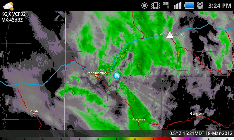
I think we all slept in a bit after the previous night's fun, which was probably good.  We hit the road by late morning under cloudy skies and I knew that we'd be facing rain in the afternoon when the cold front arrived and possibly more light warm air advection stratoform precip before then.

It's funny traveling with Brad and Brian.  Both are avid fishermen and they look at the rivers like I look at the skies.  I think there is a mutual respect of each other's passion.  

The parking lot was half-full as we arrived around noon.  Brian didn't have a lot of time to waste, so we immediately began our trek up the hill.  I decided to keep my camera stowed on the way up the hill to save time and only shoot on the way down, so Brian could go ahead if he was running short on time.

We found the trail to be muddy and quite icy in spots.  I witnessed several people fall on their hikes down.  Though the previous night's revelry did have some impact on my constitution, I trudged on up the hill and remained steady on  my feet.

There was more snow than on my previous trip, so that subtly altered the character of the trail, which was nice.  Another strange thing was that the water level in Dead Horse Creek was lower, but it was flowing in more areas.  Last time, the creek disappeared beneath the earth for several long stretches.  Perhaps, though the water level was lower, the ground was frozen which resulted in more surface water in spots.  That is just speculation.

It rained and snowed occasionally, but never heavily on the way up.  After reaching Hanging Lake, I waited for people to cease climbing out onto the long log which floats upon the surface and then paused for a few pictures.  Brad and Brian stared into the water and watched the trout (or char, perhaps) swim about.

I'm not sure what it is with Hanging Lake (and I found this last time as well), but I was having trouble being happy with my compositions.  On the bright side, or dark side I suppose, it was dark enough for longer exposures, so that is a plus.  Here are several pictures that I'm not necessarily sure if I like.  Enjoy. 


After hanging out at Hanging Lake for a bit (get it?), I wanted to show them Spouting Rock.  So, we hiked a little farther on the trail... it only takes a couple of minutes.  I was happy to see a giant ice pillar next to the falls, which still emerge directly from the face of the rock.  At some times of the year, an additional waterfall pours off the top of the cliff.  The ice pillar is a result of that flow.  We spent some time looking around and I took probably too much time trying to get some good images.  I have trouble deciding which ones are more presentable, so I've posted quite a few.  


I could tell Brian was ready to get on the road, so I tried to put my camera away, but not before getting a few more shots.  I was crouched behind a rock, against the wall to get the best angle when a woman walked up.  Apparently she didn't see me until she was right on top of me, because she jumped about a foot in the air.  I captured a couple of good frames from that spot, though.


The drizzle continued as we began our trek down the canyon.  I stopped once more at the top of the falls over Hanging Lake for a couple of shots.

Rain & Snow obscuring the view.


On our way down, I ran into a young lady that didn't have a camera.  I awkwardly tried to explain how to get to my blog.  (Hope you got a chance to check out the photos!)  It made me realize that I need to have an easier name than "bigskyconvection" ... thus my eventual pull toward "alwayschasing."  Too bad I'm paying for hosting on the former and everything is already locked down there, including all of my old blog entries.  Eh, I'll figure it out some time... anyway, back to the trip.

Poor Brian did biff it once on the way down and luckily, I believe, didn't do any further damage to his arm.  I saw plenty of others fall too on the icy path, but I remained on my feet.  It was very difficult not to stop at every little riffle in the creek and take pictures, though I did stop at a few.


Once at the bottom, Brian headed back to Denver and me and Brad wandered on in to Glenwood Springs for a late lunch.  We were referred to Vicco's Charcoalburger.  I was hoping for a place to sit down and eat but I didn't realize it was a drive-in until we arrived.  At that point, I was too hungry to go some place else.  We originally planned on eating outside, but the cold front arrived at that moment...  FROPA! ...and ruined any thought of that.  It was incredibly windy!  So, we ate in my car.  Honestly, I wasn't a big fan.  Both Brad & I had mushroom & Swiss burgers.  They use fake American-style Swiss cheese, though, which is awful.  The smoke sauce was decent, but the burger overall was kind of disappointing.  The chocolate malt was runny and unpleasant as well.  We had full bellies, though, so I suppose that's all that really mattered.

On the way back, we battled light rain and wind with occasional bursts of heavy snow.


We topped off the evening by watching John Carter of Mars, which was pretty good.  A lot of it was shot in Utah and I recognized several areas which I told Brad we'd be driving by on the next day.  Our plan was to visit Arches.

Here's a useful map:


Dann.

Tuesday, March 13, 2012

2012 Storm Chase 2 - February 28th - Meanwhile, On The Other Side Of The Hill

I hadn't planned on chasing storms on this particular Tuesday, February the 28th, but somehow it just worked out that way.  I was indeed hoping that something would have happened the day before, but we were still in warm air advection mode, which is not a good place to be on the Western Slope in the late winter if you want convection.  It's simply too warm aloft.  Well, the cold front passed overnight and brought rain to the valleys, which was nice.  However, in the late afternoon as the upper level low was moving through, lapse rates increased dramatically.  Convection began to fire up around the area, complete with lightning strikes.  I left home and went in to work to consult with my colleague Eddie and take a closer look at the data from my work computers.  Here was the general setup:

SPC actually had is in a categorical risk for thunderstorms on that day.  20Z Outlook

As we were sitting there, strong convection began to develop along the northernmost edge of the Uncompahgre Plateau, just south of I-70.  There seemed to be some sort of line of convergence there, perhaps minor troughing in the ULL.  Suddenly, the radar lit up with lightning strikes and even a 0.25" hail marker.  I was quickly on the road and headed northwest.


I planned to head up to I-70 to do a little minesweeping of the core as they passed over the populated portions of the valley near Fruita.  As I reached I-70, however, I looked back to the east to see something that looked a lot more dramatic than it actually was. 


Keep in mind, the view is looking east.  Mid-level inflow to the convection was coming in from the northwest, however, so the bases of the storms were in fact on the north sides of their respective downdrafts.  After a brief photo-op, I got on 70 and headed west to the next exit, then dropped onto US 6/50 which parallels the interstate so that I could have more mobility.

I cored the first cell just to the southeast of Fruita and for the first time in a long, long time, I heard hail on the windshield.  What a glorious sound!

I'm not sure if I have shared my hail scale before, so here it goes:

Tinks - 0.25" to 0.5"
Dinks - 0.5"+ to 1"
Donks - 1"+ to 2"
Bonks - 2+ to 3"
Gonks - 3"+

These were certainly tinks.  In fact, after the first, initial blast of hail, it became soft very fast and definitely more into grauple territory.  I stopped in a pull-out and opened the window, turning the inside of the vehicle into a popcorn machine.  Then, I got out and experienced the core. 

(mobile phone image)

After the initial wave passed through, most of the activity began to fade.  A burst of convection occurred the north, over the desert and I headed toward that initially, but I realized I wasn't going to catch it before it reached the Book Cliffs, so I turned back and decided to re-immerse myself in weaker convection firing along the original line back to the west of Fruita.

Just east of Loma, I got into a nice rain/snow shower with grauple mixed in and found a nice place to stop and enjoy the precip.  It turned out to be reasonably photogenic too. 


As the storm passed, the sun tried to come out a bit.  This led to a grauplebow.  Boom.


After it cleared, I decided to head north and look for a good position to take advantage of the lighting conditions.  I knew that sunset would soon be approaching, so I explored a bit to find and area worth shooting.

Finally, in full sun, the back side of the departing storms looked absolutely stellar.  There's something about winter convection that is unique and very pleasing to the eye. 

Looking northeast from 16Rd

And due east...

East-southeast...

As I reached the periphery of the desert, the Book Cliffs looked fantastic and weak convection was firing off to my northwest again.

Waves break on the Book Cliffs, freshly painted with grauple and snow.

Weak convection north in the desert.

Looking northwest into Utah

Golden hour.

For the actual sunset, I headed back to Loma and stopped just south of the interstate.  A weak shower moving over the Grand Valley turned with the setting sun's light.


And the clouds out east looked pretty nice too...


Convection died off with the setting of the sun, so I stopped back at work for a moment before heading home.  Meanwhile in Nebraska, good friends were chasing tornadoes.  But for me, it felt absolutely fantastic to get out and chase something worth chasing.

One crazy note from the day:  The moment I left the station, the lightning stopped.  I did not see lightning nor did I hear thunder.  I swear, though, before I left, it was lit up!  Guess I'll have to wait a while longer for my annual viewing of "Twister".  For those not in the know, I always watch that terribly awesome movie every year after the first time I hear thunder.

Oh yeah, and my good buddies Scott Hammel and Eric Treece spent their day chasing the first tornadoes ever to be recorded in Nebraska in the month of February.  


Detail Map:


STATS
Mileage: 57
2012YTD Mileage: 79
States: Colorado
SPC Risk: Categorical
Max Hail: 0.25"
Tornadoes: None
Other Phenomena:  Grauplebow
Applicable Mesoscale Discussions: None
Applicable Weather Watches: None
Storm Reports for February 28th

Other Chasers' Reports:
- Scott Hammel - Stapleton Nebraska Tornadoes


Dann.