Showing posts with label tropical cyclone. Show all posts

Monday, December 22, 2008

Late December Severe Event?

Well, well, well, what have we here? Chaser friends are abuzz with a late December chase possibility. I will, of course, be enjoying the company of my family seemingly above the Arctic Circle in Montana. If the models verify, we will have a strong weather-maker crossing the CONUS. It looks squall line-ish, but you can't rule out some spin-ups, especially if we can work out some supes just ahead of it. It will be interesting to watch for the next few days.


SPC even has a Day 5 out on the situation already. I haven't seen one of those in at least a month.


And one final thought ... current tropical activity.


Satellite imagery used with permission; courtesy of IPS Meteostar Inc. Click for larger images.

Dann.

Friday, December 19, 2008

December Convergence! & The Tropics

December's Convergence! is tonight.

It will be held at the Tivoli Student Union Building on Auraria Campus. I will be doing a short presentation on the Alta Vista Tornado. It's nothing special really, I'm just trying to help fill time. It will focus on some of the mesoscale features and be filled with pictures and video.

Starts at 5:30PM tonight (hopefully I can get there on time!).

Did I mention free food and drink?


Also, I've been enjoying the tropical cyclone season in the Southern Hemisphere, so here is an update.

Satellite imagery used with permission; courtesy of IPS Meteostar Inc. Click for larger images.


UPDATE on yesterday: The snow came quick yesterday and was gone. There were some reports of thundersnow east of town and lightning detection did show a couple strikes.

I'm not sure how much updating I will be doing over the next week and a half. I have a busy weekend ahead and two long days in the office, Monday & Tuesday. I will be traveling to Montana for Wednesday through Monday and my parents have dial-up. :)

Dann.

Thursday, December 18, 2008

Nature Is Go'n'a Get Ya'

Nothing ground-breaking to say today, so I'll let the pictures and video do the talking.

I stumbled upon the following graphic on AOL News yesterday and it gave me a little chuckle. There have been several other versions of this map published in the past 24 hours, but I think this is one of the more simple ones to look at and understand. It basically describes how likely you are to be "dead by nature" by region.


The cold air has moderated over the last couple of days. The storm system that brought snow to Las Vegas yesterday has also plowed over most of the west. Everybody seems to be getting snow. We have a few showers in the Denver area right now, but nothing to write home about.

The situation developing in the midwest and Ohio Valley should be interesting over the next few days. Death, destruction via ice and snow. Prepare for those headlines.

... but, the cold air will return to the northern Rockies as exemplified in this forecast pulled from the Butte, Montana NWS point forecast page.


Looking in on the warmer latitudes ...


Satellite image used with permission; courtesy of IPS Meteostar Inc.


On the lighter side, this was posted over on Storm Track today.


Weather Channel Accused of Pro-Weather Bias


UPDATE:
We just had a nice graupel shower a minute ago. I took some pictures but don't have my cable with me. Hopefully I'll have them up tomorrow.

UPDATE 2:
Quite the wave of showers that have just come off the mountains. We could be seeing some heavy snow with embedded small to moderately sized graupel. I wouldn't be all that surprised to see reports of thundersnow. Lightning is quiet for the time being, but I'll keep my eyes out.


Dann.

Wednesday, December 17, 2008

Cold Tropical Explosions

Okay, a couple little updates today.

Going back and looking at climatological data, I found that the actual lowest temperature in the lower 48 (at least) on December 15th was -39ºF at a COOP observing station along the Canadian Border (6N Simpson, Montana).

On the 16th, both Harlem and Chinook, Montana reached -35ºF (as well as Longville Minnesota as I previously reported.

And finally, here are some not-so-cold things to consider...

In the tropics:
04S (South Indian Ocean)
40kts / 993mb

Click for larger image. Satellite image used with permission; courtesy of IPS Meteostar Inc.

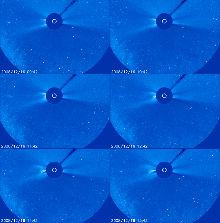
And a giant explosion on the sun. (posted by someone over on Storm Track)


Thanks for shopping,
Dann.