Showing posts with label tornado. Show all posts

Tuesday, January 06, 2009

Tuesday, January 6th Update

Not much too exciting going on out there right now. There is a tornado watch in Mississippi and Alabama right now and a couple warnings have been issued. These look to be spinups or supercellular segments in the line of storms pushing through. I wouldn't be too excited to chase these storms as if they do produce, chances are the tornadoes will be shrouded in rain. Compound that with the low cloud bases and the tree-cover, and it wouldn't be too fun. Nw would I be out if I lived down there? You bet I would!

Elsewhere, the Northwest continues to get battered with system after system. They may see a little break later this week and might catch a quick glimpse of the sun. In Alaska, it is very cold right now. This cold air will probably be blocked from reaching the lower 48, but we may see a brief intrusion in the Great Lakes region. The west looks to remain ridged with a few impulses riding over the top.

Here in Colorado, this means wind and downslope warmth in the short term. A weak surface boundary make work down the Front Range toward the weekend cooling us off a little, but pattern won't change much in the next week.

On a walk today, I saw some great Kelvin-Helmholtz Waves over the Front Range. Unfortunately, I had left the camera in the office. When I got back, I ran outside and took a few shots, but they weren't quite as intense. I hope to have those pics up soon.

Finally, a look at the tropics:

Still looking pretty quiet right now. There are a couple areas of interest in the West Pacific and the South Indian, but none look favorable for rapid development at the moment.


Satellite imagery used with permission; courtesy of IPS Meteostar Inc. Click for larger images.


Dann.

Monday, January 05, 2009

2008 Storm Chase Year In Review

Total Mileage: 5114
Total Chases: 11
Tornadoes: 1
Updated 2008 Chase Map
Key: Yellow counties are counties chased in. Green are new to 2008. Red are counties where a tornado has been observed.

I.April 23rd
Location: E Colorado, NW Kansas, SW Nebraska
Mileage: 483
Chase Partners: Cameron Redwine, Cutler Gosbin, Kendall LaRoche
Description: The dryline started firing (in far-east Colorado) just before we arrived. The closest storm was tornado-warned. We circumnavigated the core to the north and got in position to the east. The east-southeasterly inflow was brutal and kicked up a lot dust, but we finally got close enough to see the beautiful meso. It lost strength at that point, so we got under the core and experienced some 1" to 1.5" hail. We followed the storm into Kansas but it died, so after a brief detour to the far southwestern corner of Nebraska, we headed home.

Beautiful mesocylone.


II.May 21st
Location: E Colorado
Mileage: 461
Chase Partners: Eric Haave
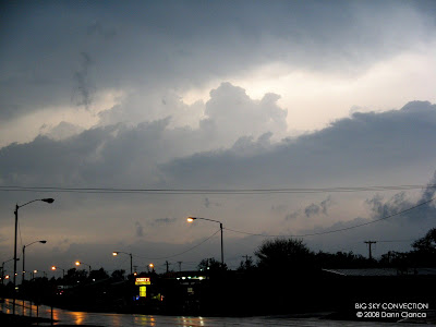
Description: First chase as a degreed meteorologist! Not much to speak of here. Nothing really exploded like we'd hoped. We ended up settling for sunset photos and hoped for some lightning at the end of the night. It was one of those classic nights where you're seeing CG after CG until you stop the car and get your equipment out.

Sunset on a not-too-stormy day.


III.May 23rd
Location: NW Kansas
Mileage: 668
Chase Partners: Francisco Alejandro Lopez-Cruz, Katie Crandall
Description: No radar, no nowcast support, and getting there late = frustrating storm chase. Tornadoes were ongoing as we arrived in Kansas. We were west of the line and the storm on I-70 right in front of us had baseballs. I knew if we dropped south, we might not catch anything, so I elected to drive north and around, dropping south toward Wakeeney. Well, we never made it. The next three hours were spent in heavy, awful rain and by the time we got to Hill City, the action was over for the day.

The first time we were not in heavy rain in about three hours, Hill City, Kansas.


IV.June 2nd
Location: NE Colorado
Mileage: 132
Chase Partner: Karissa Sanford
Description: Convection fired very late in the evening for Denver standards (latent surface heating broke a weakening cap at sunset). Storms fired all over the metro area and most were rotating! The storm of the day was out east, though; absolutely gorgeous on radar. We headed east of the city to intercept the storms coming off the foothills but decided to stay on the gorgeous cell out east. For whatever reason (and I still regret this), we stayed to the west as the almost-dry RFD put up a nice shelf cloud. I definitely felt limited by time that night and as a result didn't go further east. I wish I did. That storm was in completely open country at night. No buildings, no people, only cows. If it produced, no one would have known. ... and do to my decision-making, no one does.

Mesocyclone of small storm over the Denver-area, looking west from where we stopped to view the supercell to our northeast.


V.June 19th
Location: NE Colorado
Mileage: 64
Chase Partners: None
Description: Similar set up to the previous chase, though no beautiful supercell out east. The storms on the north side of the city quickly died, but the ones on the south, enhanced by the Palmer Divide remained strong after dark. This was definitely one of the most beautiful nights I've ever had. The coloration of the storms at sunset along with the lightning show was amazing. I had a hard time deciding which photo to include, but since I spent an awful lot of time using the church as my subject, I've picked my favorite of that set.


VI.July 2nd
Location: NE Colorado
Mileage: 225
Chase Partner: Tony Laubach
Description: Marginal day again, but went out for fun for the most part. Chased some high based linear-stormage out of Greeley east toward Fort Morgan. It was very pretty for a while. We ended up punching the line twice and then hanging around Brush to observe the flooding.

Nice burst of precip from strengthening line of storms.


VII.August 13th
Location: East Central Colorado
Mileage: 320
Chase Partner: Michael Carlson
Description: Another marginal eastern Colorado setup. Given that the day before had yielded some very photogenic supercells for Mike Umscheid, I was eager to get out. Michael and I had been wanting to chase together all year and we were both available. He kept eye on a leftover outflow boundary from the day before, so we stuck on that when we went out. Our first storm formed and we followed it through all of it's glory over the course of three hours. It was low-precipitation and unbelievably gorgeous. It almost went through the storm split process before becoming more surface-based and began to spin like a top. It wasn't until it interacted with the old boundary that we experienced tornadogenesis. The tornado (an EF-1) was not very photogenic, but it was amazing. We ended up following the storm after the tornado dissipated but the RFD came down (have great shots of the RFD hole) and wiped out the rotating updraft.

The Alta Vista tornado just before dissipation.


VIII.August 26th
Location: NE Colorado
Mileage: 375
Chase Partner: Michael Carlson
Description: The photo below should have been a clue. Yes, that is the crappy cumulus cloud on the dryline flipping us the bird. That was pretty much all that happened that day. We instead headed up to Pawnee Buttes for a more nature/landscape photo op. When we got home and I went to bed, amazing lightning was had by all (except me) in the metro area.


IX.September 21st
Location: NE Colorado, Nebraska Panhandle
Mileage: 494
Chase Partners: Jonathan Splitt, Jeff Auger
Description: Had to choose, cell coming off the Cheyenne Ridge or stronger cell (much farther away) in the panhandle. We chose the distant storm and hauled to catch it. Luckily, it right-moved in a favorable direction and we at least got to observe it before it died. On the way home, we were surrounded by beautiful constant lightning emitting storms. Easily the best lightning night of my life. I chose to include a picture of the supercell, however as even though I got 60+ lightning shots, the supe was my favorite.


X.October 21st
Location: East Central Colorado
Mileage: 452
Chase Partners: Michael Carlson, Ryan Shepard
Description: Another marginal (what else!) day for chasing. Was supposed to be the "last chase" of the year. We had a little convection along the cold front, but it was elevated and got wiped out quickly. We tried for some lightning afterward but it was too infrequent.


The cold front (elevated convection behind it).


XI.November 5th
Location: Oklahoma
Mileage: 1440
Chase Partners: Ryan Shepard, Johnathan Skinner
Description: The "real" last chase of the year and this one was a "marathon" chase ... lasting over twenty five hours. We got up early and drove out to our target (between Wichita and OKC). Storms fired ahead of the dryline after the garbage convection started to clear out. Most storms were HP and some rotated. The first intercept was a beast. Our second, much farther south, was also gorgeous. We got perfect position on it just after dark (right in the bear cage) and observed a scud funnel right under the wall. If it would have been a little lighter, I think I wouldn't have any doubts about whether it was rotating or not. I still do. It was right overhead! We drove all the way back to Denver that night.


High-Precipitation Beast.


Career stats:
Chases: 49
States chased: 6
Counties chased: 91
Mileage: 16998
Tornadoes: 1


Bring on 2009!!!

Dann.

Saturday, December 20, 2008

Cold Cut Switchblade

Well, it's getting a little chilly here again tonight in Denver. As it stands, it's 16ºF with a light breeze at my apartment. The sun was out most of the day, but it never really got much above 30ºF. While that doesn't seem all that cold, the wind sure had a knack for cutting right through me.

Montana is seeing very cold weather again. Temperatures dropped below -20ºF in many locales yesterday and have returned that low already tonight. The GFS and WRF did not show the quick drop in temperature tonight for the area. I wonder if they are having trouble with the timing of the system in the northwest. The warming in Montana just doesn't seem to have begun just yet. In fact, there are some readings below -25ºF currently and even one (Kevin, MT) at -31ºF.

Last night (Friday, the 19th) was the third installment of Convergence! The AMS Club at Metro State was kind enough to host the event and it took a slightly different turn than normal. Instead of just hanging out at the bar and swapping stories, we had a forum to share media. It was a lot of fun (-beer).

I was asked to fill some time so I did a presentation on the Alta Vista Tornado. More specifically, I wanted to talk about how sometimes storm chasing is just about going out and working with what you have. It seems like a lot of attention is paid to the moderate to high risk events. Well, in this case, we saw something happen one day, saw the same pattern the next day, and got lucky. I also wanted to show people that a non-traditional storm (in this case, a VERY LP-supercell) can still tornado under the right circumstances. I tried to cover this as best I could given the documentation that I had. However, my power-point presentation did not make it to the event intact. Unfortunately, I only linked the diagrams and pictures instead of inserting them. So, of course, nothing showed up. Luckily, I was able to talk my way through with some stuff I had uploaded to the infobahn and a couple secondary things that I had remembered to bring. Hopefully people enjoyed the talk.

Tony Laubach was up next and he presented the May 29th chapter of his latest chasing DVD. I had already seen it, so I knew what to expect (though thoroughly enjoyed it for the third time!), but it was cool to hear the oohs and ahhs from the audience.

Next up, we got to see some of the May 22nd chapter of the latest Carlson Chasers DVD. I had seen some bits and pieces before but it was nice to see the full presentation. I still need to pick up a copy of their DVD.

Cameron Redwine then wowed us with some slide of his storm photography. He doesn't have much material online or I'd link him, but he has some fantastic shots. He's been chasing in Colorado since 1997 and has documented completely with use of a film camera. It definitely gave me an appreciation for the film quality.

Kendall LaRoche was next and he showed some pictures of his front porch storm spotting, which was cool. I had the pleasure of bringing him along on his very first storm chase back in April. You should have seen his face the first time we saw lightning on that particular day.

Finally, Dr. Richard Wagner (from Metro State) did a presentation of below-zero climatology for Denver and finished it up by talking El Niño and La Niña trends here.

There were some new faces there, which was nice. Some of them were chasers and some of them not. All in all, it was a fun night.

The next event is tentatively scheduled for Saturday, January 31st.


A couple days ago, I promised some shots from our grauple/thundersnow event. Though I didn't hear thunder, there were several reports in the metro along with some lightning strikes showing up.


I've enjoyed putting the information on the tropics in my posts for the past week. For some reason, the last couple years have seen me more excited about the Southern Hemisphere season than the more "local" events. I guess if you're reading this, let me know if you like seeing the tropical weather on here.


Satellite imagery used with permission; courtesy of IPS Meteostar Inc. Click for larger images.

And finally, Michael Carlson posted this link on Storm Track recently. I figured I'd share it as well.

The Big Picture (2008 Year in Photographs)
Part I
Part II
Part III

Dann.

Friday, December 19, 2008

December Convergence! & The Tropics

December's Convergence! is tonight.

It will be held at the Tivoli Student Union Building on Auraria Campus. I will be doing a short presentation on the Alta Vista Tornado. It's nothing special really, I'm just trying to help fill time. It will focus on some of the mesoscale features and be filled with pictures and video.

Starts at 5:30PM tonight (hopefully I can get there on time!).

Did I mention free food and drink?


Also, I've been enjoying the tropical cyclone season in the Southern Hemisphere, so here is an update.

Satellite imagery used with permission; courtesy of IPS Meteostar Inc. Click for larger images.


UPDATE on yesterday: The snow came quick yesterday and was gone. There were some reports of thundersnow east of town and lightning detection did show a couple strikes.

I'm not sure how much updating I will be doing over the next week and a half. I have a busy weekend ahead and two long days in the office, Monday & Tuesday. I will be traveling to Montana for Wednesday through Monday and my parents have dial-up. :)

Dann.

Tuesday, November 11, 2008

Less Likely Places

Things have slowed down quite a bit since the chase last week. I will say, however, that I spent most of the day on Monday watching the weather; both here and elsewhere. Everyone had been preparing for a severe weather outbreak in central Texas. For a brief moment, I had considered finding a way to make the trip. Cooler heads prevailed, though and I decided to take a day at home ... being productive. Well, I wasn't productive, but this isn't really a personal blog, so I won't dwell on that.

I was intrigued early in the day by reading Mike Umscheid's blog. He had forecast a possible tornado threat for area around low. Most of the play would be along and ahead of the dryline in Texas, but he had his sights up north. Reading that, I recalled his presentation at the Chaser Convention a couple years ago about the cold core setup and the famous "tumbleweed tornado". So, I pulled up GR3 on three locations: 1) Here in Denver to watch the snow event if it possibly unfolded, 2) Alternating between Dodge City and Pueblo, tracking Mike, and 3) Various sites in central Texas.

Frustration, similar to that coming out of chasers in Oklahoma last week, could be felt from the Texas setup. Yet, I was delighting in the action in SW Kansas. I think I was chasing vicariously through Mike. I'd watch the cells go up, see him (on Spotter Network) core one; moments later a hail report showing up. Next thing I know, the cell is tornado-warned and I knew it was him. Awesome! So, congrats to Mike on netting the only tornado of the day anywhere in the U.S. ... and more ironically, in SW Kansas where the temps were in the low 50's. Incredible.


A not-too personal update on me:
Still job hunting. Still existing. That is it.


And, now some pictures to pretty up this blog:

I went downtown to attend a hockey game with my uncle and cousin who were visiting from Montana. The sunset was gorgeous ... and luckily, I had my camera. The first set is of the Tivoli Student Union Building on Auraria Campus (various perspectives).


And a couple of the game ...

This turned out to be an Avalanche goal ... see the puck?


And finally, sunset from the office on November 6th:


Dann.