
Here is the agenda:
6:00 PM -- Mike Nelson Intro and welcome
6:20 PM -- Tim Samaras - Tornado Expert - featured in National Geographic Magazine, "Inside Tornadoes - The Latest Research: Twistex 2008"
7:00 PM -- Tony Laubach - Storm Chaser - "The Windsor Tornado vs Douglas County Landspouts"
7:40 PM -- Dr. Walt Lyons - Lightning Researcher - "Flash Facts - Red Sprites, Blue Jets and Other Rare Airities"
8:20 PM -- Ethan Greene - Director, Colorado Avalanche Information Center - "Avalanches and the Big Snow Winter of 2007-08"
9:00 PM -- Dr. Thomas Schlatter - NOAA's Earth System Research Lab and the University of Colorado - "The Pine Bark Beetle - A Canary for Climate Change?"
9:40 PM -- Questions
More information can be found HERE. If you're in the Denver area and want to go, there still may be seats available ... contact info is on the linked page.
The Milk River Supercell
This might be better placed in a separate post, but I wanted to mention it here anyway. My passion for meteorology was birthed and nurtured by Montana weather. It has long been my desire to intercept a tornado there. Before I moved to Colorado, I had never really gone storm chasing (according to my current definition of the term), though I did "follow" a few storms or go out onto a hilltop to take one in as it passed. I had the opportunity to actually chase in July of 2007. The setup was marginal, but I was able to intercept a beautiful, high-based storm off of the Crazy Mountains, providing one of the most beautiful stormscapes (in combination with the topography) that I have ever witnessed. There is an inherent beauty to the place, something, that I believe, sets it apart from elsewhere in the United States.
I feel very connected to the land and the sky in Montana and was very inspired after reading the story of Bear White Child of the Crow. (It's worth the read)
It is my intent to spend more time chasing in Montana in the next few years. While watching the weather elsewhere and especially locally, I still always have an eye on the weather in Big Sky Country, or known to some as "The Last Best Place." With the droves of storm tourists now piling onto the plains of Oklahoma and Kansas, tempered with the "try this at home mentality" after absorbing the myriad 'reality' storm chasing shows, it seems like Montana might be a good place to escape the crowd. Chasing has always been a spiritual experience for me, but a personal one at that. As much as I love to chase socially (and that has been the case with higher gas prices) ... I never feel more at home than when I am out under a storm, all by myself.
Montana doesn't have near as many severe days as most of the United States, but don't let that fool you. There are a couple favored setups where things can get absolutely wild. The state can be split in half climatologically with the mountains on the west and the plains on the east. There is one event that seems to happen every year, without fail, and sometimes more than once. I call this the "Milk River Supercell".
I intend to research this storm via climatology and in the field.
Here is a brief overview of the storm:
Most often, the Milk River Supercell forms off of the Rocky Mountain Front (not to be confused with Colorado's Front Range) and travels in an arc from west to east slightly north and then slightly south, roughly along the path of Montana and Alberta's Milk River. It often targets the city of Glasgow, MT before moving off into the Dakotas, sometimes as a mesoscale convective system. This storm usually begins as a low precipitation supercell and can sometimes evolve to have high precipitation characteristics. Though further research is required, it seems to form on days where abundant Pacific moisture is available in the mid-levels, usually associated with a short wave riding up along the mid to late summer Rocky Mountain ridge. At the surface, Gulf of Mexico moisture is plentiful thanks to the low level jet and a sometimes a Canadian moisture advection mechanism that I wish to study is also present. With the varying moisture sources and topography in Montana, it could seem like meteorological chaos ... but the boundaries can lend to some explosive weather. This is what I want to study and observe. It will take a more climatological approach at first and then hopefully get to study an event in the field. This could be difficult with my distance, uncertain (eventual) job placement, and having to rely on lucky timing, but it is something that I really want to be a part of.
One such storm on June 16th, 2007:
Glasgow NWS writeup
Severe Reports
Radar Loop
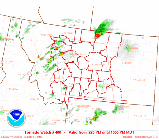
Sure, the Milk River Supercell isn't any more severe than the behemoths that form on the plains in the early spring, but it is special to me. With a poor road network, marginal phone service, and not very many people, it is literally just you and the storm.
Dann.


No comments:
Post a Comment